
Understanding Your Zoning Analysis
Reading the Zoning Map
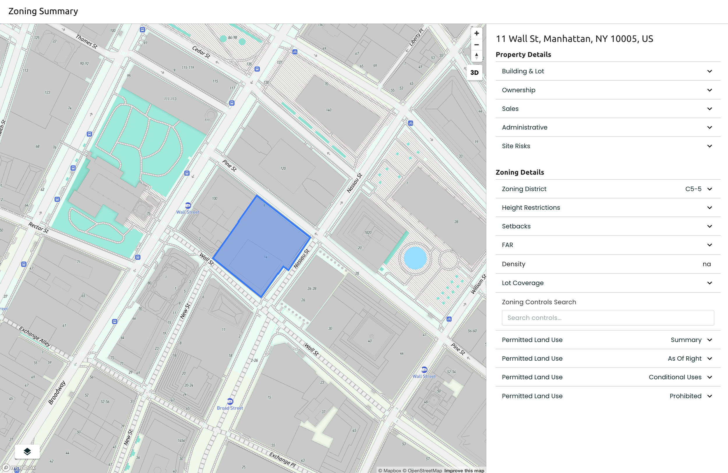
2
The color-coded map shows different zoning classifications. Each color represents permitted uses and development standards:

Click on a nearby parcel to start a new study for the selected property
Key Terms
4
FAR (Floor Area Ratio)
The ratio of total building floor area to the lot area. A FAR of 2.0 means you can build twice the lot's square footage.
Height Restrictions
Maximum building height allowed, typically measured in feet or stories. May include stepped height requirements.
Setbacks
Required distances between buildings and property lines. Includes front, rear, and side yard requirements.
Understanding what's allowed on your property is crucial for development planning, here are some examples of what you might see:
Permitted Uses
5
Permitted By Right
Conditional Use
Single Family Residential
Multi-Family (Up to 4 units)
Accessory Dwelling Unit
Ground Floor Commercial
Short-term Rentals
Home Office
Prohibited
Heavy Manufacturing
Gas Station
Adult Entertainment
You can use the search bar in the zoning controls to search for specific zoning information
If you encounter NA in any data field it means that there is no data available for that metric. If you think this is an error or need support in finding this information, reach out to help@algoma.co
6
Reading the Zoning Data
Interact with the Zoning Map
1
Opening the map layers will show you the toggle to view parcels and zoning districts for surrounding areas.
Exploring nearby parcels
3